Rage

17 MAY 16
Appalachian Trail/Great Smoky Mountains Nat’l Park: Day 2
Mollies Ridge Shelter- Derrick Knob Shelter
Miles today: 12

“Make your feet your friend.” – J.M. Barrie


-My newest (and longest to date) trek- hiking the Great Smoky Mountains National Park end to end along the Appalachian Trail. All waypoint mileages are measured in the trip miles AND their northbound distance from Springer Mountain.-

I woke up from a restless night of sleep totally spun around in my sleeping bag. Normally, if I lay on my back, the bag zips up on my left side. Somehow I managed to get the bag rotated around me in such a way that the hood was on top and the zipper was on my right side. The new Thermarest NeoAir XLite in combination with my rain fly (covering the floor) AND my sleeping bag made for quite the slippery evening.

Silnylon (nylon impregnated with silicone for supreme water resistance) is very good and reliable, but it’s slippery as all get out. Same goes for all the uber-lightweight fabrics most of my gear is made out of. It’s a well documented problem that sleeping pads inside tents are notorious for sliding around, and last night was no different. Sadly for Grande, I kept inadvertently kicking him in his feet in my feeble attempt to re-center myself in the sleeping bag on my pad. He chuckled and said I was doing 360 degree rolls all night not unlike an alligator doing “death spins”. Such is life.

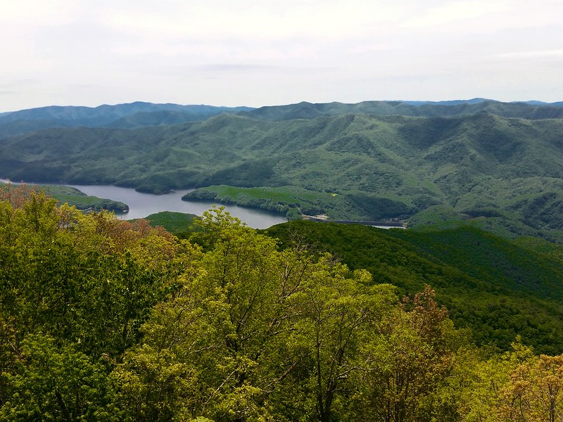
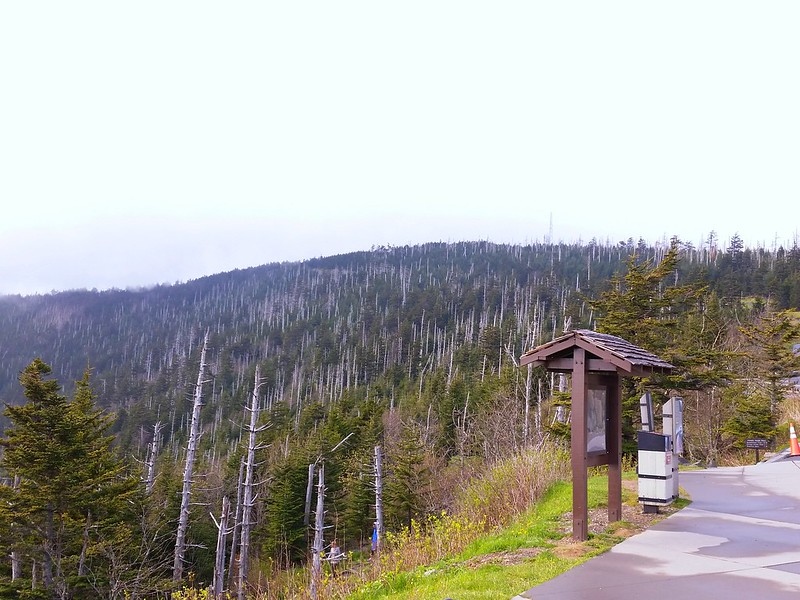
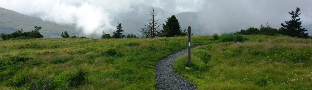
Near Eagle Creek Trail and Spence Field shelter

I also found out that the top shelter platforms (where I prefer to be) are not really designed for tall people. One, I kept hitting my knees on the beam every time I bent my legs up. Two, when I was on my stomach sleeping, my feet managed to get wedged in a small space between the platform & the back wall. After the second time I awoke like that I was so tired I didn’t even care.

Had slightest discomfort in right hamstring last night as well. Not enough to take any meds for, but enough to concern me. Here’s hoping it doesn’t come back today, because even though we only have a net gain of 300 feet today, they’re going to be very hard-fought. The elevation profile looked like an EKG readout from a patient in full ventricular fibrillation. Up, down, up down, up, down.

Two shelters we passed today (Russell Field and Spence Field Shelters) were closed to hikers due to nuisance bear “incidents”.  Spence Field was the site of an event just 5 days ago where a bear actually bit a hiker in the leg through his tent. Before I say anything else, I have to mention that the hiker wasn’t practicing proper Leave No Trace.

When I first heard about the incident, my first thought was “he didn’t have all his food hung or something”, because it is NOT in the nature of black bears to out & out attack humans like that. What happened was the hiker had some sort of coconut-scented sunscreen lotion either on his skin or in his tent. Bears in the park are sometimes habituated to associate tents and packs with food, so Mr. Bear most likely bit into the tent thinking it was chomping on a food bag, not a leg. Anyway, Spence Field is closed, and sports an “electric” fence around it. The fence is only for thru hikers who can’t make it the six miles to Derrick Knob. (But what about the out of shape section hikers who can’t make it? We’re people too!).

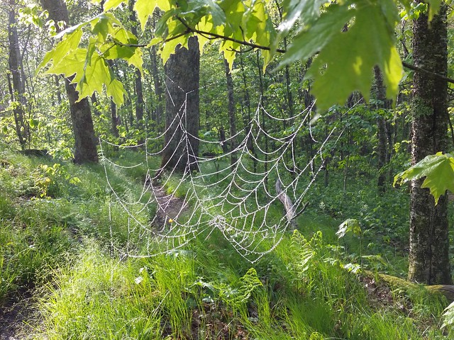
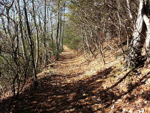
Russell Field shelter

I was the first one up and on trail this morning, and shortly after 0900 I reached Russell Field Shelter ( elev 4348; At mile 180.4/ trip mile 14.1) and stopped for breakfast. There were two thru hikers who had slept there last night, “Delicious” and “Dakini”. They were nice enough, but I didn’t understand why they decided to stop there even though the shelter was closed. Rumor was they would continue hiking after most of the guys stopped for the night so they could get some peace and quiet, but still, Russell Field was closed for a reason. To me, just randomly doing what you want when you want is a good way to get in a jam, but I digress.

This time out I brought along my “cat” stove to try out. It’s basically a Fancy Feast cat food can with holes punched in it that burns Heet (the gas antifreeze) for fuel. I tried it several times at the house and it seemed to work efficiently, but the upside was it’s weight- 0.5 ounces for the stove and 8 ounces for 4 day’s worth of fuel. What I didn’t plan for was the constant breeze blowing the ever-loving shit out of my flame, and even with a foil windscreen, it took me 6+ minutes just to boil water for my coffee, which never makes for a happy camper.

The entire morning was socked in thick fog (when it wasn’t sprinkling or drizzling). The air was cool and damp, but that didn’t ease the climbing whatsoever. My mood soon matched the gloomy conditions as my legs continued to scream from yesterday’s punishment. Walk it off, I thought to myself. Well, what else am I gonna do? Today’s highlights? Spence Field shelter (elev 4916; AT mile 183.2/ trip mile 16.6) , Rocky Top, and Thunderhead. When I came upon the side trail to the Spence Field shelter at 1100 and read the sign about bear alerts and electric fences and shelter closures, I kept going. It was too early to stop to eat again, I was still good on water after topping off at Mollies Ridge, and I couldn’t justify taking the side trip and adding needless miles to my journey. My legs thanked me.

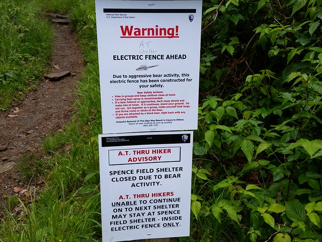
Hikers and fences and bears, oh my!

Yesterday I joked around with the thought of singing the song “Rocky Top” at the top of my lungs when I summitted Rocky Top mountain (elev 5440; AT mile 184.4/ trip mile 18.1), but I was so beat down once I got there, I couldn’t think of anything else except getting my pack off and eating, so I took a well-needed lunch break there. The sun peeked out a few times, and at least I was rewarded with a few slight views of the surrounding Smokies.

It is a lot steeper than it looks.

From Thunderhead north, the trail only continued to insult me. Where nice, gradual  switchbacks could have been constructed were only arrow-straight paths taking you in the most direct route upwards. On more than one occasion I tried to mentally summon Bob Peoples (legendary trail maintainer) to please appear before me and carve an easier way around this hill.

Fun “Fact”- Legend has it that every time Bob Peoples constructs a switchback, and angel get its wings. Ha!

Help me, Obi Wan “Bob” Peoples, you’re my only hope. (Photo courtesy of Bill Garlinghouse)

At one point, the trail drunkenly went up a rocky boulder, and I couldn’t help but laugh at how silly it all seemed. Seriously? Okay then. That’s pretty much how the rest of my day went; my feet ached from being hyper extended and flexed on the severe angles, and my arches were taking a beating from being stretched and stabbed on rocks. I cursed the trail, then the people who constructed the trail with wanton disregard for humans, then I cursed anybody who didn’t seem like they were about to go into cardiac arrest, then I went back to cursing the trail again. Irrational? Yes, but it got me up that damn hill! My speed dropped down to an abysmal 1.4 miles per hour, but at least I was making forward progress.

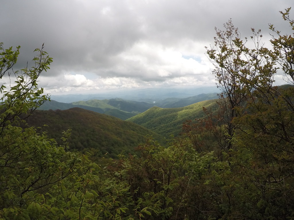
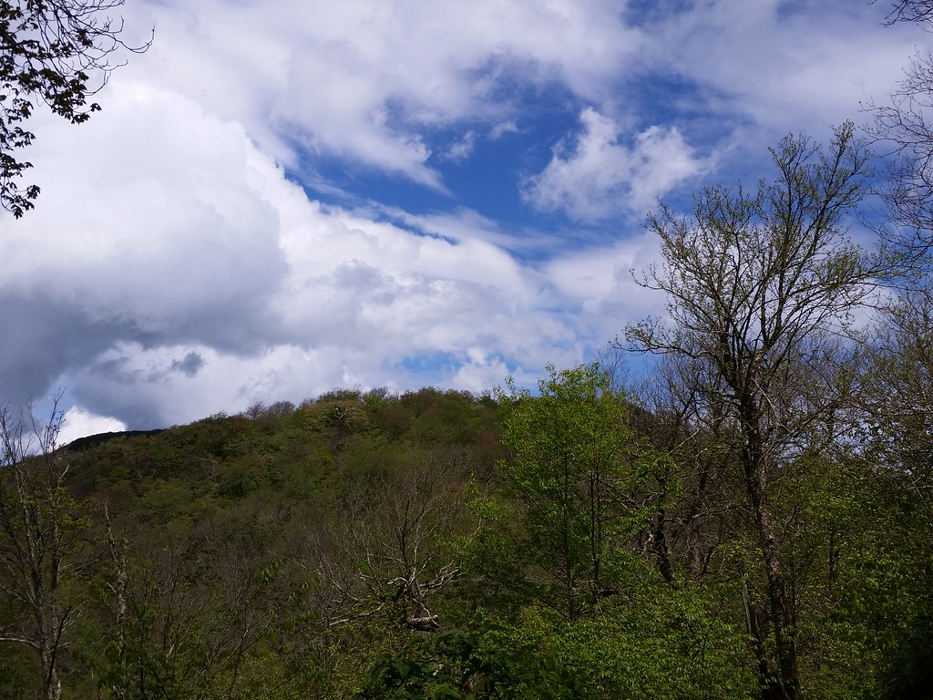
View from near Rocky Top

Later that afternoon, I found Stitch, who had the contents of his Osprey Exos spilling out onto the trail. He showed me how half of the volume of his pack consisted of food, and everything basically was shoved in where it would fit. I grabbed a spot next to him and set the timer on my phone, since it was one of my “mandatory” sit-down-and-take-your-pack-off-and-really-rest kind of stops. We talked about various things, from his painted toenails to the lack of women minorities on the trail. A few jokes were made, then I started complaining about how I was getting my ass pretty much handed to me, and how I was angry at my poor performance. He asked “are you always this mad about random things?” and I concurred. The conversation went on about the various forms of my self-anointed trail name, and eventually, after singing a few lines of an old rap song, the name “Rage” kind of stuck. The rest, as they say, is history.

At 1700 sharp I finished the day’s hike with a final, discourteous ascent up to Derrick Knob shelter (elev 4882; AT mile 189.3/ trip mile 23). Every other time I hike, I’m going downhill to a shelter. So far, every one here is up a hill. There was no shortage of things to complain about I guess.

Derrick Knob shelter

A group of six or seven thru hikers showed up, and something told me it was going to be overflow conditions. Nora & Britches had already saved a spot on the top bunk for me, but after I saw a few guys pitching their tent, I longed for a little privacy and the decent night’s sleep that my tent might offer. Stitch urged me to just go ahead and pitch it, “who’s going to know if you’re a thru or not, the shelter is full regardless, but I insisted on playing by the rules. Not ten minutes later, another thru showed up, and when I asked if he wanted my spot in the shelter, he replied with a resounding “hell yes!”, and I happily set up 20 feet away.

Note: The rules along the AT in the Smokies are that everyone must stay in the shelter and are NOT allowed to set up tents or hammocks. The only exception to the rule is AT thru hikers are allowed to tent/hang if and only if all the available spots in the shelter are full. Derrick Knob has a capacity of 12 people, and there were about 20 folks on site. The rule is in placevto minimize impact on the land, not to separate thrus from section hikers, so it didn’t matter who tented, so long as the shelter was at capacity, so my exchanging a spot with a thru was allowed.

Beautiful!

The night ended on a good note- three deer walked right up through the “toilet area” (there is no privy at the shelter), and hung out right behind my tent grazing quietly and ever so peacefully, aware but unafraid of the humans a mere 20 feet away. Harper & I were standing at the side of the shelter watching them when one decided to entertain us by stopping for a quick poop right in front of us.

Stitch told me one final time to “fix your attitude, the best is yet to come- you get to climb up to Clingman’s Dome tomorrow”. Yeah, don’t remind me. The highest point in Tennessee. The highest point on the entire Appalachian Trail.

I’m looking forward to being angry again tomorrow.

Too tired to sing. (click for video)

Straight up, no chaser

16 MAY 16
Appalachian Trail/Great Smoky Mountains Nat’l Park: Day 1
Fontana Dam- Mollies Ridge Shelter
Miles today: 11

“It’s always further than it looks. It’s always taller than it looks. And it’s always harder than it looks.” – The 3 rules of mountaineering


-My newest (and biggest to date) trek- hiking the Great Smoky Mountains National Park end to end along the Appalachian Trail. All waypoint mileages are measured in the trip miles AND their northbound distance from Springer Mountain.-

My trip this time out was going to be somewhat of a group meetup- I met Paul (Sondance Kid), Nora (the Explorer), and Micah (Lil Britches) on Whiteblaze- they’re hiking on to Hot Springs after I get off the trail at Davenport Gap. Since I was apprehensive about sleeping in the shelters (after reading several accounts of renegade mice sprinting across hikers’ faces), I figured it would be a little better with people I at least knew for more than 3 hours. I arrived in Gatlinburg yesterday and after briefly meeting the crew and watching the race, spent an hour or so walking up and down this strange little tourist trap in the middle of nowhere. That night I weighed my pack, and it topped out (with three days of food, minus water) at 19.4 pounds. With a full load of water, I’d still be right at 27 pounds, and that’s pretty manageable. One liter of water= 2.2 pounds= 35.2 ounces. Ahh, the things you commit to memory!

The four of us met the next morning at Newfound Gap (where US 441 crosses the park) and were shuttled by Vesna from the shuttle service A Walk in the Woods, leaving promptly at 0800. She was very knowledgeable about the Smokies, and instead of catching a few z’s on the trip I was listening intently to what she had to offer up.

“The Smokies are home to an estimated 1,600 black bears, two per square mile”.

“The mountains were formed approximately 200-300 million years ago, making them among the oldest mountains in the world.”

“It is one of the largest blocks of old-growth forest in North America, and boasts the southernmost boreal spruce-fir forest on the continent.”

“This will be a very challenging hike. Your total elevation gain with all the ups and downs will be just shy of 20,000 feet.”

Sounds good, let’s get to it.

We arrived at the Fontana Dam Visitor’s Center (elev 1700 ft; AT mi 166.3 / trip mi 0) about 0930, and after the requisite last rites on the porcelain thrones (to no avail, my intestines were locked up tighter than airport security) we set off. I had initially started to walk back to see the “Fontana Hilton” shelter- I’d heard it was pretty nice as far as shelters go, but Paul was calling out to me- guess he wanted to start as a group I guess. With my Go Pro camera rigged on a stick pic (that I eventually lost halfway up to Shuckstack), I was able to get some excellent footage walking across Fontana Dam. As we were crossing, what was undeniably the Shuckstack Fire Tower on the ridge jutted upwards from the mountain.

Fun Fact- Fontana Dam, completed in 1944, is the tallest concrete dam east of the Rocky Mountains.

The first two miles weren’t too bad, it was a road walk across the dam and then alongside the same road entering the park, but then it shot straight up. Welcome to the Smokies. Nora went up ahead of us while Sondance & Britches chatted heartily on the way up. 4.5 miles later at 1245 we took the Shuckstack fire tower (elev 3889 ft; AT mi 170.8 / trip mi 4.5) side trail. A few other hikers there eating and resting. No one really wanted to climb the tower; some were afraid of heights, but hell, might as well. The weather was pleasant and I wasn’t too tired (yet). There wasn’t really any need to go all the way to the top- I just wanted to be above the surrounding trees on all sides. There was another hiker named Harper who was doing a LASH (Long A** Section Hike) from Springer to Hot Springs. (Conversely, I do what I like to call SMASHes- Small A** Section Hikes).

At the Birch Sping Gap campsite (elev 3736 ft; AT mi 172.1 / trip mi 5.8) I took a much-needed break and scarfed down a Snickers bar in less than a minute. For some reason, my appetite was in full swing because I was willingly accepting dried apples and jerky from the ladies as I just couldn’t satiate my hunger. Oh yeah, it was the mountain I was climbing that was responsible for my munchies I guess.

Holy hell what a climb out of Fontana it was. It went up. UP. And UP. And then UP some more. Everyone was walking very slowly and steadily. I can’t do that for some reason. I like to (or need to, I can’t tell) take longer strides at a slightly faster pace. Unfortunately, this tires me out very quickly, so on a very steep incline, I end up stopping every 60-70 meters or so to catch my breath for about 15 seconds, then I’ll continue. I was doing pretty good training earlier this spring with a 36-pound pack, but wasn’t doing inclines like these, and not for this long either. Plus, all my training had come to a sudden stop the last two weeks before I went out. At least the steroid shots in both hamstrings were doing their jobs- the old hammies weren’t giving me grief like they usually do. No sciatica either, and that made me happy.

Stopped again at Ekaneetlee Gap (elev 3842 ft; AT mi 175.6 / trip mi 9.3) for another quick break and to take my pack off again. Topped off with 3L of water because I’d heard the spring at Mollie’s Ridge was” somewhat reliable” according to the guide. I would soon regret that decision.

Finally arrived at Mollies Ridge shelter (elev 4,586 ft; AT mi 177.3 / trip mi 11) at around 1730. There I met flip-flop thru-hiker “Stitch” from Florida- he’s doing his 3rd thru hike. He also hiked the PCT and the Florida Trail. I couldn’t help but wonder where does he get the time & money to do that? He’s not married, has no kids, oh well, I guess he’s living the life of Riley, but I didn’t ask. Some people like to leave a little mystery and he was just that kind of guy.

Fun Fact- According to an old Cherokee legend, Mollie was a woman who died on this ridge searching for her lover after he failed to return from a hunting trip.

I lost the tightening screw to my stick pic somewhere on the way up because it was no longer attached to my trekking pole. Well, that lasted all of 2 hours. Before the next trip, I’ll have to find a way of engineering a rig that won’t come off so I can continue to use my Go Pro.

To my dismay, it seemed like everyone saw a bear today except me. Nora saw one when she went to get water. It was the funniest thing- she volunteered to take everyone’s bottles. About 30 seconds after she left the shelter, she came back walking rather briskly, shaking her head with her eyes wide. “Uh-uh, no water. There’s a bear down there” she said. Apparently, he was in a tree, and jumped down & ran away when she got close. Sondance & a few others could see it from the bear cables. I had my shoes off & didn’t get over there in time. A hiker named “Grande” and his girlfriend came in later that evening right before sundown. He’s nicknamed Grande because he’s about 6’5” and skinny. He said they had seen four (!) bears at the Birch Spring Gap campsite.

Harper chimed in and said he’d seen one at Ekaneetlee spring on the way to the shelter. Yes, the same spring where I’d carried all that unnecessary water. I say unnecessary because later on I went to get water here at the shelter and the spring was just fine, thank you very much.

For dinner, I had one of my favorite Mountain House meals, the Mexican style rice & chicken that turned out to be more of a “sopa” than anything because I added too much “agua” to the bag. It didn’t matter- I was bound and determined to eat whatever soupy mess I had concocted tonight.

The shelter wasn’t as bad as I thought it would be. It was actually pretty nice for a wooden building housing smelly transients in the wilderness. There were only about nine people actually sleeping inside the shelter; a few thru hikers came up & immediately set up their tents outside. Lucky. I’d love to sleep in my tent.

Here’s hoping a wretched mouse doesn’t crawl across my face tonight.


Decision Point

18 MAY 16
Appalachian Trail/Great Smoky Mountains Nat’l Park: Day 3
Derrick Knob Shelter-Clingman’s Dome (and then some)
Miles today: ~12

“Remember when life’s path is steep, keep your mind even.”- Horace


-My newest (and longest to date) trek- hiking the Great Smoky Mountains National Park end to end along the Appalachian Trail. All waypoint mileages are measured in the trip miles AND their northbound distance from Springer Mountain.-

There are days when you wake up and just know you’re not going to perform as well as you did the day before. No matter how much you try to not be self-defeating, you just know. This is one of those days where I was going to have to stop, regroup, and reassess my ability to complete what I’d set out to do. The only other time I bailed on a hike was near Erwin after Big Bald kicked my ever-loving ass (read all about it here). In hindsight, I could have finished it, but I’d doubted myself then, and I was doubting myself now.

Today’s hike was supposed to be 13.5 miles to Mt Collins Shelter. That wouldn’t be so bad if it weren’t for the last two days absolutely wreaking havoc on my legs & feet. They were killing me. Something else weird happened last night. Right after sunset, what seemed to be an low-flying jet passed overhead. Then it came back. Then there were two of them. Fighter jets? Yes, fighter jets were buzzing around right over our location at Derrick Knob. Now, I’m not one to get upset at military training of any sort; I’m totally accustomed to hearing artillery fire, attack & transport helicopters, and various aircraft flying overhead (due to my proximity to Fort Bragg, NC). But out here where I’m try to find a little solace? Right over the Smokies? Really? That was irritating. I cursed the jets under my breath, and after about 15 minutes of annoyance they went away.

Admittedly, I don’t recall much from the hike today except pain. No amount of using my poles to “massage” my tired muscles (as my physical therapist taught me to do) worked. I was being very careful about how much Motrin I was consuming, but it didn’t work. Stitch commented on my “gangsta limp” when I first emerged out of my tent this morning to retrieve my food bag. “It’s not a gangsta limp, my legs aren’t working right now” I replied. “well, today is a new day with a new purpose.” It is. Today is all about milestones, and that milestone, Clingman’s Dome, was 10.2 miles away.

I set off just after 8. After about 90 minutes, members of the “thru crew” started trickling by. Squatch was first, then Red Beard, then a few others whose names I didn’t recall. The trail rose and fell, rose and fell, with no appreciable gain in elevation, but the saving grace of the morning was a spectacular ridge walk along a narrow spur covered with light green, wavy grass, and what I believe was beech trees (I could be wrong).

Grassy spur

I stopped at Siler’s Bald Shelter (elev 5453 ft; AT mi 195 / trip mi 28.7) for an extended late breakfast/early lunch. Most of the Derrick Knob crew was there, including Stitch, Paul, Nora, and Micah. I made it a point to lay out my Tyvek ground sheet, take off my shoes, and relax as much as possible. Lunch consisted of a Rice Krispies treat, more of the unbelievably messy pepperoni stick, and a smoked chicken salad from Packit Gourmet, which was pretty damn good, but by now I was pretty much forcing food down- my appetite wasn’t there. The other thing about Siler’s Bald shelter was the flies. It seemed like every species of bug with wings had taken flight and migrated there. Clingman’s Dome was 4.5 miles away.

There were some decent views at the actual Siler’s Bald summit (elev 5607 ft; AT mi 195.2 / trip mi 28.9) and a couple of miles later at Jenkins Knob. I pressed on to Double Spring Gap Shelter (elev 5510 ft; AT mi 196.7 / trip mi 30.4), which strangely enough, was less than two miles from Siler’s Bald. Most everyone in my little “bubble” was ahead of me, but I sat around to take in the views, although it was starting to get cloudy and misty. The spruces and firs, after making cameo appearances after Siler’s Bald, were becoming more apparent the higher I went up.

Silers Bald survey marker

Fun Fact: Siler’s Bald was named for the Siler family, who once grazed cattle on it in the summertime.

I hadn’t been at the shelter long before two deer appeared, quietly munching on leaves and making their way towards the shelter. They saw me, I saw them, but again didn’t seem alarmed, or even concerned, about my being there. It seemed like for the last three days, wildlife migrated towards a shelter after humans had arrived there. Three hikers that I’d leapfrogged with (two from Australia) came up soon after, and we all pretty much hung out watching the wildlife show. There are two springs here (hence the name)- one on the Tennessee side, and one on the North Carolina side. Remember, the AT straddles the NC/TN border most of the way through the park, so ten steps either way put you in a different state. The spring on the NC side was literally 20 yards from the shelter. To be honest, Double Spring Shelter seemed like a very nice place to stay, and as much as I’d liked to have stayed here and called it a very early night, milestones and such. I met an Appalachian Trail Conservancy (ATC) ridgerunner named Maury on the way out. Clingman’s Dome was 2.8 miles away.

looking down towards Fontana Lake. This is the last “view” I’d get from the AT for the next 3 days!

When I got to the intersection of the AT and the Clingman’s Dome side trail, the three hikers I’d met before caught up to me. Two of them were from Australia, and the third was their “guide”, a guy named Mark. They were ending their hike from the NOC (Nantahala Outdoors Center- about 30 miles south of Fontana Dam). I knew I wasn’t going to go further, so I went out on a limb and asked them how they were getting back to Gatlinburg. Mark said they had a shuttle arranged for a 6pm pick up, and offered a ride down to my rental at Newfound Gap, as long as the driver had room for the four of us.

I mounted my Go Pro on my head strap in an attempt to capture the “magic” atop Clingman’s, but because I had the waterproof housing on mostly all you could hear was my heartbeat and pulse pounding. It was sprinkling intermittently, and the closer I got to the top, the more it came down. Since I had some time to kill, I walked about a mile further down past the tower where the Mountains to Sea Trail began, then doubled back. As if to spite me one final time, as soon as I climbed the paved walkway and reached the top of the observation tower at Clingman’s Dome (elev 6667 ft; AT mi 199.5 / trip mi 33.2), it was raining. There was nothing to see. At that point, I didn’t even care. I was heading to Gatlinburg.

View from Clingman's Dome

Sweet view from the top!

Fun Fact: The Mountains-to-Sea Trail (MST) is a long distance trail in North Carolina the begins at Clingman’s Dome and goes eastward to the NC coast.

Thankfully when Mark’s shuttle arrived, he had a Ford Expedition, so I got a ride down to Newfound Gap, which is a good thing, because none of the tourists would give me a ride down, and there was no way I was making that walk. I went back down to Gatlinburg, trying to formulate a plan for tomorrow, but the only thing on my mind was rest and recovery. I got a room at the Travelodge again, this time a much cleaner one, laid my things out to dry, showered, and hit Howard’s Steakhouse for a pretty damn good steakburger and fries. On the way back, I stopped at Old Dad’s General Store again to pick up some Motrin and a couple of beers to help me sleep. Once back at the hotel I elevated my feet and called it a night.

Looking up towards Clingman’s Dome from the parking lot. You can see the white stalks of the dead Frasier firs.


Standing Bear Farm

9 NOV 14
Davenport Gap/Snowbird Trip: Day 3
Snowbird Mountain- Interstate 40 Underpass
Miles today: 4.8

“Discoveries are often made by not following instructions, by going off the main road, by trying the untried.”

– Frank Tyger


HP Snowbird Mountain

Didn’t sleep too bad last night; I guess the cloud cover was just enough to keep the chill away a little. Awoke around 8 and dawdled breaking camp down, no rush since Kelly wasn’t due to meet me at  Exit 451 off of I-40 until around 2. Went back up to the FAA radio tower and took in the sights, snapping a few more pictures, then headed back down Snowbird. When I say headed back down, I mean meandered. Was in absolutley no rush, as there was no need to risk a last-minute spill down the mountainside.

Navigated some of the stupid blowdowns again, but at least I had figured out how to best negotiate them from yesterday. I thought it would be a good idea to mark the bad areas on my GPS and let the folks at the Carolina Mountain Club know about them.

20141109_102329
Heading down from Spanish Oak Gap

I stopped by Painter Branch again to get some water, and as I was getting myself saddled back up I heard a loud rustling noise, like a large mammal was coming down the trail. I stiffened up abruptly, and then breathed a sigh of relief when the cause of the noise was in fact not a black bear, but a group of 4 southbounders loping downhill. They stopped for a quick break and we made our introductions. They were two men, Human Torch and another guy whose name I forgot, and two women, Faith and… damnit I need to start writing these down! Sorry.

20141109_112723
Southbounders!

Anyway, I offered them the rest of my jerky since my hike was done and they were heading into the ever-loving Smokies. We talked about stopping by Standing Bear. I definitely wanted to check that place out. One of them took a smoke break ,while the rest of us headed off. Well, THEY headed off, I just kind of followed. No way in hell was I going to keep up with them, even downhill, even if I threw my pack off and started running. Of course, it wasn’t long before the smoke break guy whizzed past me as well. Such as it is, being a weekend section hiker.

At a clearing under some powerlines, I saw a text from Kelly. I called her and she said that she’d forgotten we were in Central time, not Eastern time, so she was running an hour behind. Also, that she was late getting the kids up & out to breakfast so she was actually TWO hours behind schedule. “No problem” I answered, “I’ll just hang out at the hostel a little while longer”.

Standing Bear Farm Hostel
The Standing Bear Farm cabin, with a standing bear of course!

Once I came down the hill, instead of crossing the gravel road and heading back up the trail, I hooked a right and started up towards Standing Bear. It wasn’t more than .2 miles up the road, but was steep enough to remind my hamstrings what they’d done yesterday. The hostel is actually a group of cabins and out-buildings, with the main house back a little further.

There’s a cabin, a bunkhouse, a laundry area, kitchen building, and a bunch of other cool little things. Definitely not your run of the mill farmstead. I dropped my pack outside the bunkhouse and sat down for a spell. That’s when this guy with long flowing blond hair came up. He had a cigarette in one hand and a plastic tumbler in the other. “Hey how’s it going?” he offered.

20141109_142816
Outside the bunkhouse

“You must be Rocket” I said, smiling. “Yep, that’s me, how’d you guess?” “Oh man, you’re famous. Internet famous”, I replied. We had a laugh. He took me around on a grand tour of the grounds. They have a treehouse there. A literal treehouse you can sleep in. How cool is that? He took me behind the main house where the owners (Curtis & Maria) live, and showed me another one-room outbuilding that Curtis was turning into a single room with a nice view of a pasture. The whole place was bucolic, if not a bit kitschy.

Rocket and I talked about everything under the sun; his service in the US Marines, my current service in the US Army, beer, hiking, mountains, how crazy it gets in the springtime. He said at one point earlier this year he had 40 people TENTING along the grounds- the cabin, bunkhouse, & treehouse were all jam packed. I don’t think I’d want to be around all that craziness, especially having to share an outhouse…

20141109_160403
Ol’ “Rocket” man and me

Maria came into the bunkhouse with a load of fresh blankets and I told her what a cool place this was. I saw Curtis going between the house and the little “store” but didn’t get a chance to meet him- Rocket said he’d be holed up in the house soon watching a football game. I sat around shooting the breeze with Rocket, a guy who lives up the road who came down to visit, & the 4 SOBOs for a couple hours. There was another hiker who was crashed out in the treehouse, but he eventually came down to get some food.

Once the sun ducked down behind the mountain, the temps took a nosedive, enough for me to throw my Revelcloud jacket on, and zipped all the way up. I kicked my feet up for a little while longer, long enough to make note that Rocket loves him some Jim Beam, and donated the rest of my non-perishable food to the other hikers, who were going to try to make it past Davenport Gap Shelter to Cosby Knob. Of course, the suggestion was made that they rest their weary legs for the night. Shotrly thereafter, I got the text from Kelly saying she was passing by Newport, TN, which would be around 30 minutes out, so I bid farewell to Rocket (man) and started down the gravel road to the exit. (No need to head BACK up on the AT- I’d already done that section coming up and the blowdowns were irritating).

20141107_123535-1
Down at I-40

As soon as I got rounded the bend, I saw a white car pull up. It was Kelly, and talk about perfect timing! That’s when I realized the deal we made- I had to drive the other 5 hours back home. I was tired, but had an enjoyable hike.

******************SIDE NOTE***************
A few weeks ago, I’d seen on Whiteblaze and Facebook that the owner of Standing Bear Farm, Curtis Owen, had passed away on 4 MAR 2015 from pancreatic cancer. Only 4 months had passed since I saw him. Goes to show you that life is both precious and short. RIP Curtis.