13 JUN 15
Roan Highlands: Day 1
Carver’s Gap- Overmountain Shelter
Miles today: 7 total (5.6 AT miles)
“Thousands of tired, nerve-shaken, over-civilized people are beginning to find out going to the mountains is going home; that wilderness is a necessity…”
― John Muir
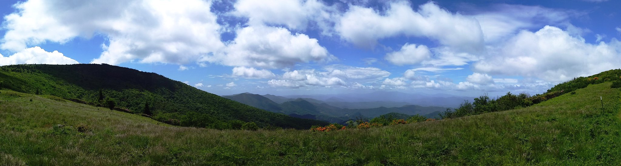
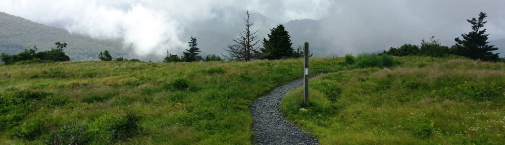
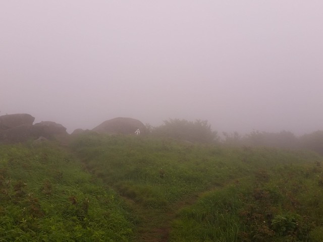
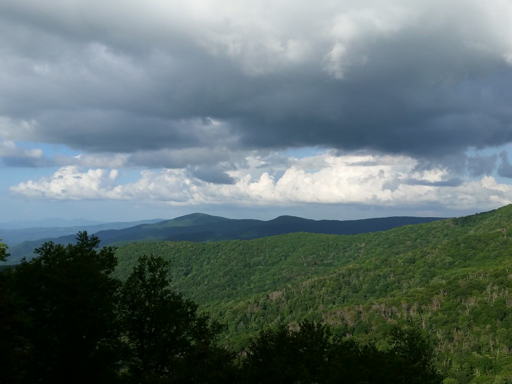
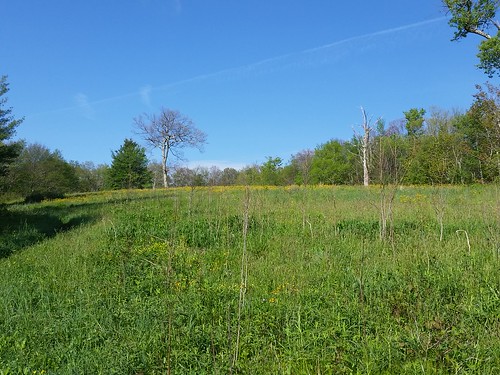
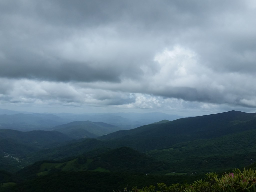
Panorama of Engine Gap
Long post warning & a quick back story:
Last year I hiked the Roan Highlands from Iron Mountain Gap northbound over Roan Mountain, and five splendid, mile+ high (and rare) southern Appalachian Balds; Round Bald, Jane Bald, Grassy Ridge Bald, Little Hump, and Big Hump. Thing is, I’d missed the rhododendron blooms by about 10-14 days. I had no idea how beautiful a hike I missed, so this year I made it a point- I was going to hike the highlands during the bloom, to see in all it’s splendor.
I had a shuttle arranged with Mountain Harbour Bed & Breakfast (& Hiker Hostel). Shannon, who shuttled me last year, immediately remembered me when I called, so we had a great chit-chat on the way up to Carver’s Gap (which I ended up splitting with three other guys and a cute Irish Setter). She told me Vagabond, who was kind of taking care of the hostel last year, had gone to visit her grandson, and she still planned to thru hike the AT again for her 75th birthday. Insane.
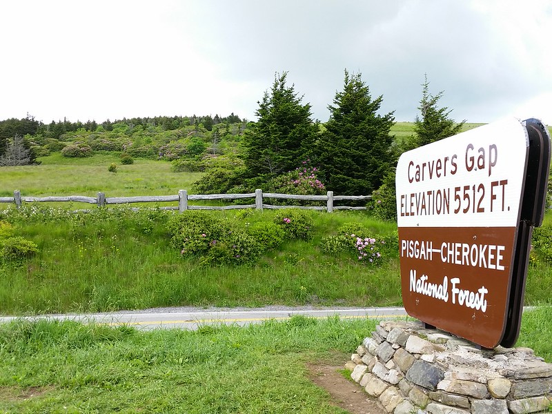
 We got up to Carver’s Gap (mi 377.5, elev 5512 ft) to be dropped off, and HOLY CRAP! You would have thought the Grateful Dead was playing up there. Wall to wall cars, trucks, buses. People were scurrying all around like cockroaches. Here’s the thing- it was a Saturday, and I hadn’t thought about the other thousand people who would be out day hiking, sightseeing, and otherwise enjoying the same massive rhododendron bloom I was there to see. All over Round Bald (mi 378.2, elev 5826 ft) were people, people, people.
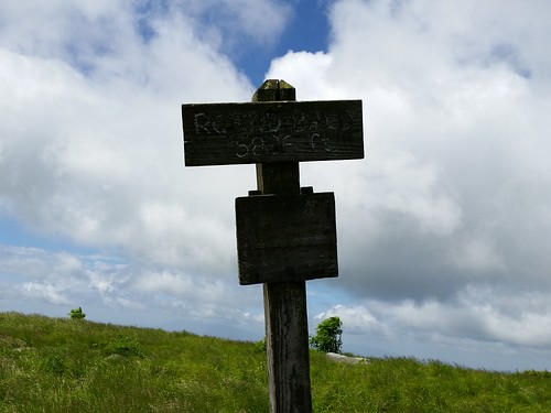
Jane “is” Bald?
Needless to say, I quickly grew irritated at the zombie horde. The worst were the uber-important photographers, who were becoming visibly annoyed at the hikers and day visitors who were obviously keeping them from the epic shot. No, I take that back- the worst was the 3 or 4 massive herds of youth groups/college students/tourists, all clad in their respective clan’s t-shirt uniforms, forming a conga line snaking up the 18 inch wide trail. A group of red-shirts here, a group of blue-shirts there…madness. They were EVERYWHERE. One of the key tenets to “Leave No Trace” is to not travel in groups larger than ten people. This way you alleviate the “stampede” effect in the backcountry. Not today. I felt instantly transformed to the Great Plains in the heyday of the wild buffalo storming across the midwest. Ugh.
Fun Fact: Jane Bald is named for Jane Cook, who died in 1870 nearby as a result of milk sickness.

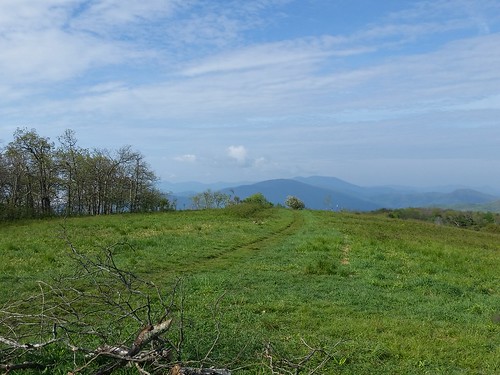
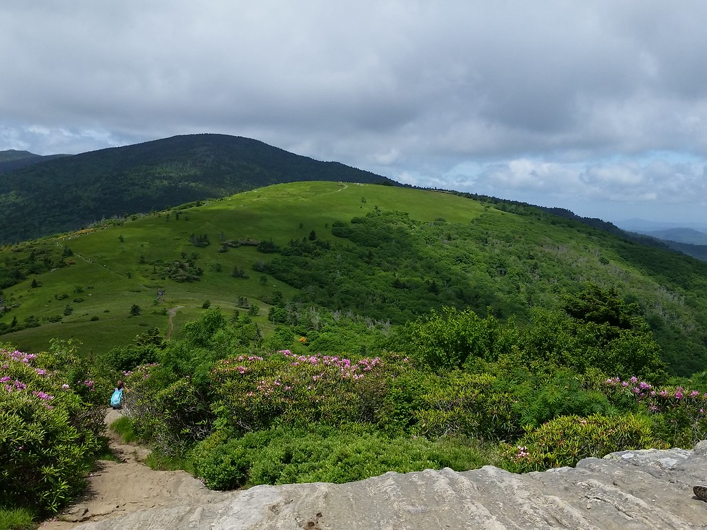
Looking towards Grassy Ridge from Round Bald
So again, there were the day-hikers, tourists, the wild herds of youth groups, the all too important photographers, and then the hiker–hikers, those of us going just a bit farther than the 5 miles to Grassy Ridge Bald.
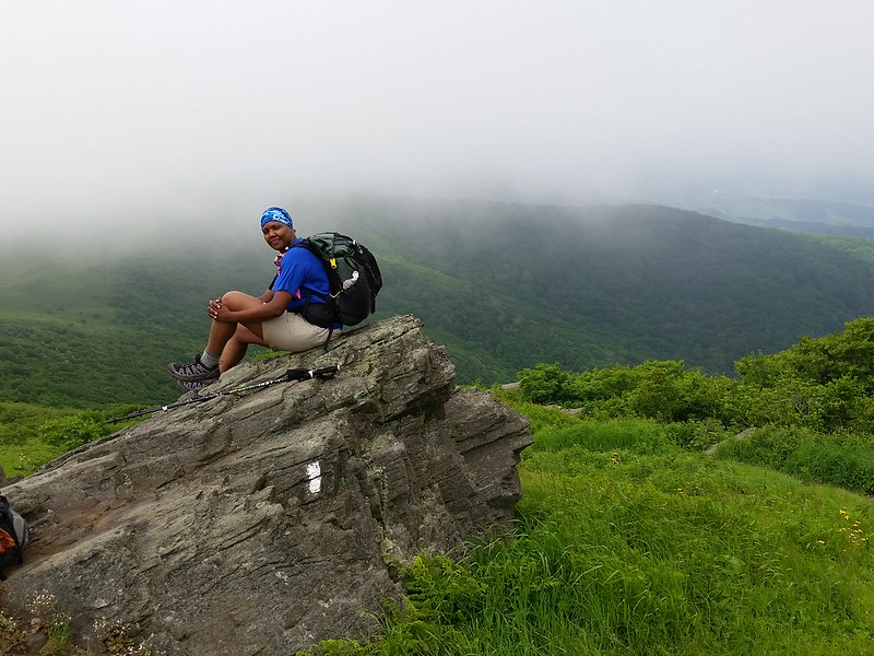
The AT doesn’t traverse Grassy Ridge Bald (elev 6165 ft). There’s a spur trail that goes to its summit, and since I didn’t stop last year (I was too concerned with racking up miles to get to a campsite), it was on my checklist today. A few people who saw I was hiking solo offered to take my picture as I summited Round Bald (mi 378.2, elev 5818 ft) & Jane Bald (mi 378.9, elev 5,809 ft). On the cover of the ATC guidebook for Tennessee-North Carolina (and several images on the internet) there is a photo taken from a rock formation on Jane Bald that looks back towards Round Bald, with blossoming Rhodos and the Roan massif in the background.
Roan Mountain from Jane Bald with Round Bald in the foreground

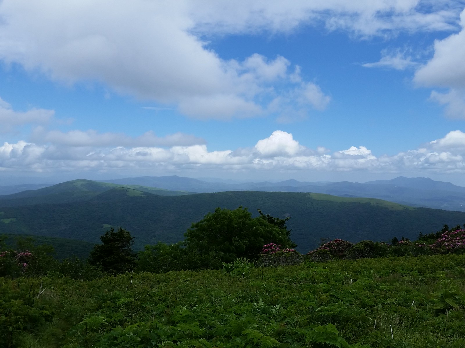
Looking east. Those two distant balds are Little Hump & Big Hump Mountain. I’ll be there tomorrow!
I got a chance to snap that picture, but couldn’t stick around to enjoy it- when I wasn’t stopping to take pictures I was huffing & puffing up the trail trying to put as much distance as possible between me and the shouting, squealing, giggling, complaining mass of millennial angst coming up behind me. Sadly, since I was actually carrying a tent, food, sleeping bag, etc in my pack, coupled with the fact that they were all about 23-28 years younger than me and NOT carrying gear, I had to pull over and let them pass. Luckily their guide (shepherd to the lost sheep, baaaa) said they were going no further than Jane Bald. Yay!

Does this look familiar?
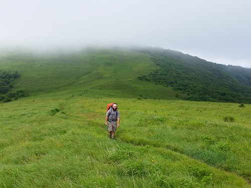
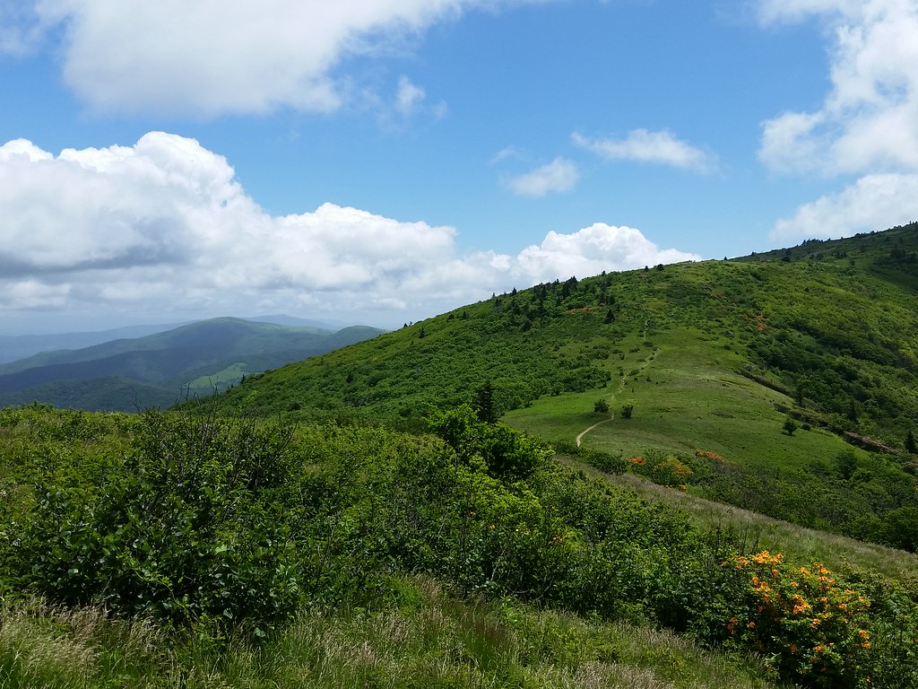
Once I veered off to the trail leading up Grassy Ridge Bald the crowds thinned out. there were still a substantial number of people, just in groups of 2-3-4. Once off the Appalachian Trail, the treadway narrowed considerably and it felt like bushwhacking at time through the dense rhododendron tunnels. At the first summit I passed a few choice campsites, and although kind of envious that I wouldn’t get to enjoy the awesome sunset/sunrise I knew the occupants would have, I was determined to stay at the Overmountain Shelter this trip (I’d been there last year but didn’t stop, more on that later).
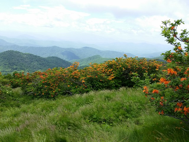
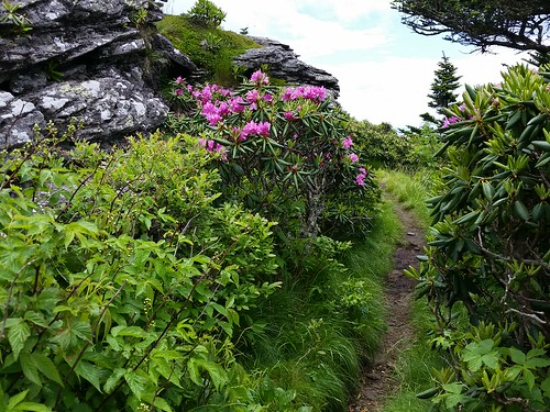
Flame Azaleas blooming near Engine Gap
Not only were the Rhodos blooming, but the flame azaleas (Rhododendron calendulaceum) were adding to the palette, contrasting their bright orange flowers with the deep pink hues of the Rhododendron catawbiense. These two hues set against the somber gray of the massive rock slabs and boulders, the emerald-green grass of the clear, open bald summits, the foreboding dark green color of Roan Mountain looming to the south, and the stunning blue sky and bleach-white clouds made for quite the interesting palette. Crowds be damned, I was glad I came.
Fun Fact: Grassy Ridge Bald is the second-highest open bald in the Appalachians. Only Black Balsam Knob near Asheville is higher.

Looking back towards Round Bald. Roan High Knob is center, and Roan High Bluff is to its left
Another look at the “Humps”. Beech Mountain is the far peak left center
From Grassy Ridge Bald looking SE. Table Rock (center) is visible with Hawksbill to its left.
An older gentleman saw me taking pictures of some of the far-off summits, and kindly let me know what I was looking at on the horizon. Most of the peaks to the northeast, east, southeast, and south I was familiar with: Mount Mitchell & Mount Craig, Table Rock and Hawksbill Mountains overlooking the Linville Gorge (I must hike that soon), Roan High Knob and Roan High Bluff, and the distinct jagged silhouette of Calloway Peak on Grandfather Mountain. He went on to show me Grandmother Mountain with a large antenna spire on it, Beech Mountain off to the west, and Sugar Mountain dead ahead.
From right: Grandfather Mtn, stupid condos, Sugar Mtn, Beech Mtn, the “Humps”. Big Yellow Mtn is the clearing center right.
Mount Guyot (in the Smokies) is visible in the distance behind Roan High Bluff.
Rant- Atop Little Sugar Mountain, clearly visible from most peaks within a 50 mile radius and in the shadow of Grandfather Mountain, is an abomination to the beautiful vistas in the area; a 10 story condominium called Sugar Top built right on the ridgeline. I’d read about this in an ATC magazine last year, and when I saw it, I was immediately disgusted. Long story short, once this eyesore was completed, it spurred a grass-roots movement and legislation preventing further development on the state’s mountaintops. You can read about it here. Years ago I probably wouldn’t have cared much about it, but I guess being able to enjoy hiking in the backcountry got me a little closer and appreciative to Ma Nature, and I don’t like seeing her spoiled. Rant over.
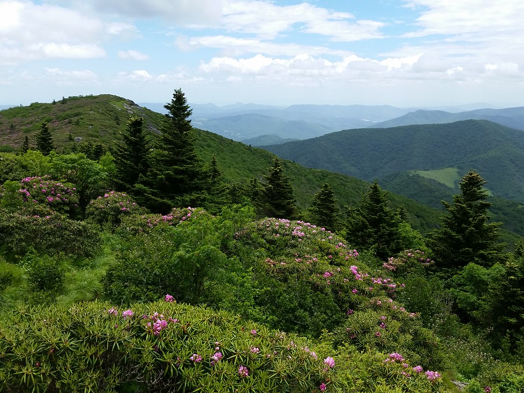
Rhododendrons among the rocks
Once I was coming down around the backside of Grassy Ridge Bald, the crowds immediately thinned out, and the forest enveloped me within its gentle green arms yet again. I encountered a few people on my way to Stan Murray Shelter, where I stopped to sign the log book (this time I got fancy, using a pink & blue pen and an NC REI sticker). Onward to today’s goal- the Overmountain Shelter (mi 383.1, elev 4654 ft).
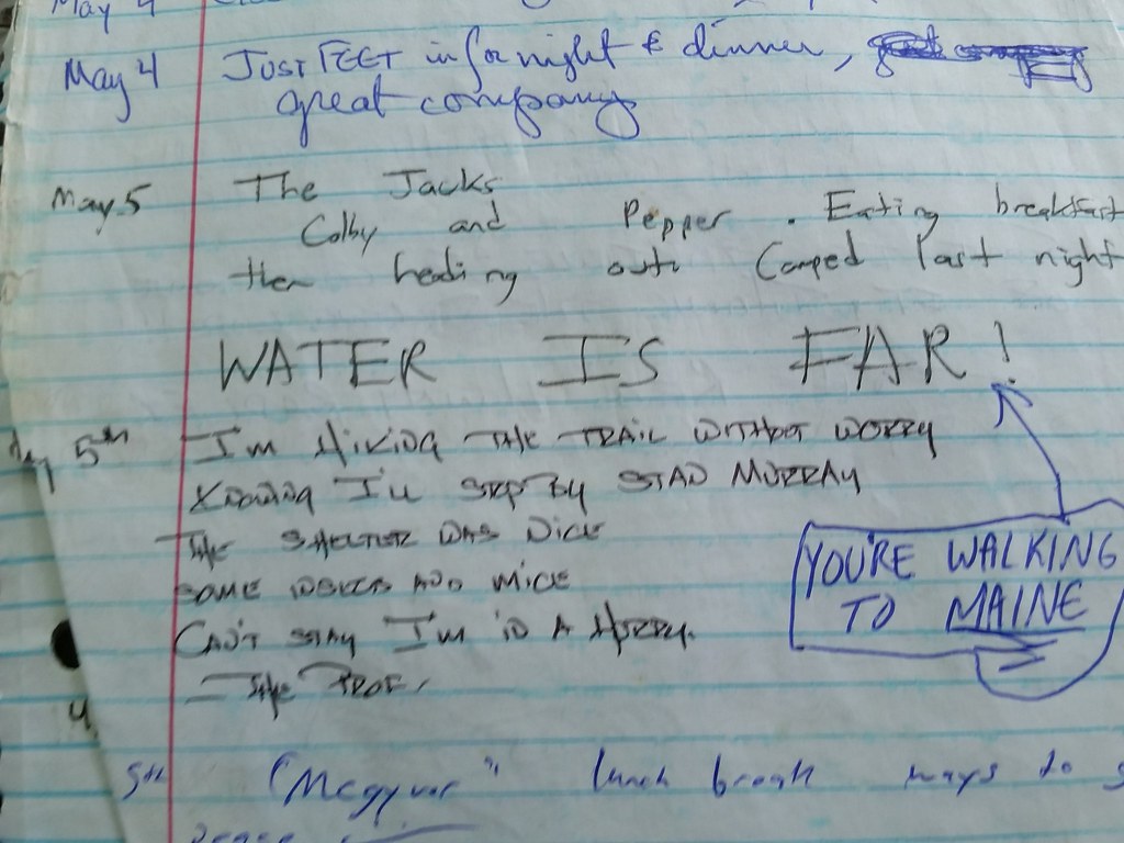
Haiku and sarcasm at Stan Murray Shelter
When I turned to the side trail, who did I see? The three guys that shared the shuttle with me, and their dog, Owen. Owen started wagging his tail and panting, and one of the guys said, “Hey he remembers you!” I gave little old Owen a couple of hearty pets, and asked the guys if they were camping at the shelter. They declined because they figured it was too crowded (you could hear people talking from up on the AT). I told them of the next couple of camping areas up on the summit and at the bottom of Little Hump, and off they went.

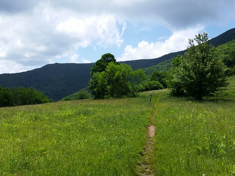
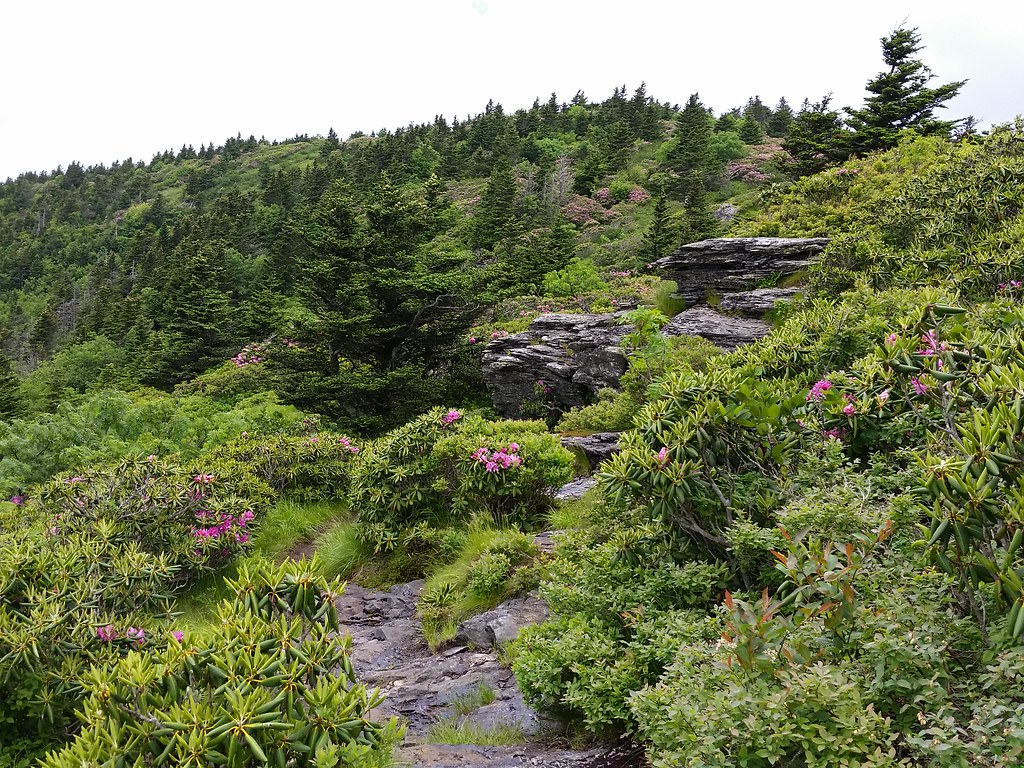
Heading around the northern side of Grassy Ridge
Yup, there was a crowd already at the shelter. It has a pretty large open area for camping, and there were already seven or eight tents set up (one was a six-person behemoth!), and a rather loud group of about ten people hanging out. I initially set up on the far side, but ended up moving to the front platform on the bottom floor of the shelter, not wanting to be disturbed by the crowd that looked like they wouldn’t observe “hiker midnight”.

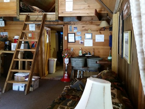
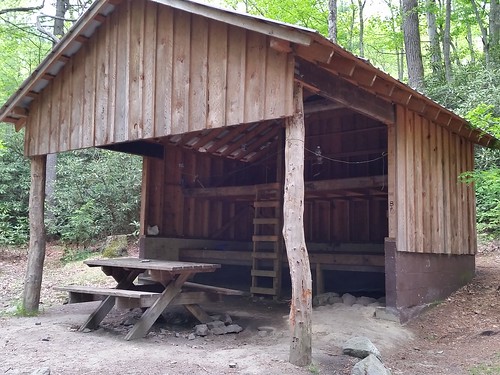
Overmountain Shelter
Soon a few more people showed up; a lady from Florida (Emmy) and her 14 year old nephew Zachary, who hung a hammock between the support poles, another group that came in around 7:00, and a few stragglers here and there, some that I recognized from Mountain Harbour waiting for shuttles. Having said that, the place was pretty packed- I’d say about 40 hikers in all. those of us who weren’t with the first group kinda congregated in our own area. The other groups were twenty-somethings, and we were all 30+, so naturally we kind of migrated away. One particular group of ladies was from a hiking meetup club in the Atlanta area. We chatted about our experiences (one hiked the Camino de Santiago trail in Spain, one hiked the Grand Canyon).
More rhodos and rocks
That’s when I saw a familiar face. (Stay with me- this is going to get funny). I’d remembered this lady from the B&B, notably from the yellow t-shirt, but there was also a defining characteristic about her- she was black! HOLY CRAP! We do exist! Ha ha ha, I finally met another black female hiker. Trust me, I cracked more than a few jokes about this to the crowd. first thing I said was “we HAVE to take a picture together- this is like spotting two unicorns in the wild!” Everybody had a good chuckle out of that. Those of you who know me personally know I like to joke like that. Now I admit, not a lot of very few black women are interested in going out in nature, getting sweaty & dirty, hiking with 25+ pounds on your back, and not showering for a few days, so it’s pretty cool to see someone who “gets” it. “Turtle” & I chatted for a while, comparing experiences and all that. She mentioned that some guy up by Grassy Ridge said “you’re only the second African-American woman I’ve ever seen out hiking, and I saw the first one about an hour ago”. That made me laugh my ass off, so the ladies said we should be called “Number One”, and “Number Two”. Funny as hell.
We all steeled around the fire with the other couple, Mog (pronounced with a long “o” who wore a kilt) and his girlfriend Loopy. Mog started playing a small little flute (almost like a miniature recorder) and I thought to myself “wow, a bunch of somewhat smelly hikers, a guy in a kilt playing a flute, a fire, out in the middle of nowhere; I have discovered my inner hippie”. Somehow I fought the urge to take my Crocs off and dance around the fire…
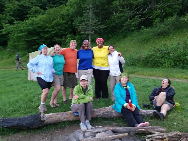
The gang
Once it got dark & everyone retreated to their tents & I went back to the shelter, a few more hikers had set up shop. Three of them were thru hikers: Andre (who hadn’t yet had a trail name bestowed upon him), a young woman named “Trail Magic”, and a young guy named “Jukebox”. I moved my stuff over so Trail Magic could have some space, and Jukebox was on the other platform.
As I started falling asleep that night, I noticed that the fireflies were putting on quite the show. Apparently this is their prime mating season, and it was like a hundred little miniature yellow-green lights going off; from what I heard, the male would light up first, then all the females would light up in a synchronous fashion, kind of like saying “hey handsome, I’m over here”. It was really interesting. Everything would be dark, there would be a single flashing pattern somewhere, and seconds later a whole buttload of flashes lighting up. I recalled the same thing happening to me last year when I was up this way, but now I knew what it was, and I was lulled to sleep by the mating call of the fireflies.

The Overmountain Shelter facilities
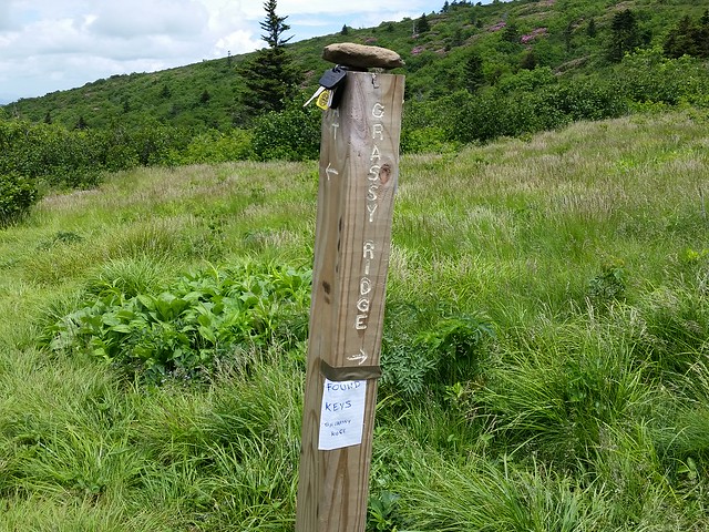
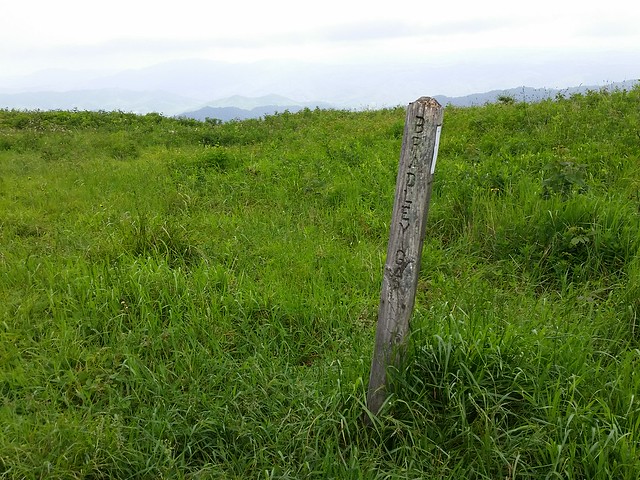
I found someone’s keys coming down Grassy Ridge. Hope they got them!