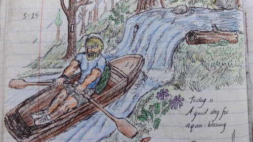
20 SEP 14
TN/NC Section 11
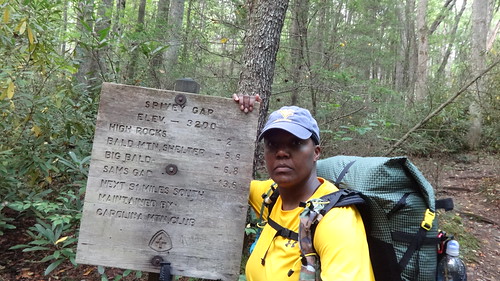
Big Bald- Spivey Gap
Miles today: 6.9
FINALLY! I got a good night’s sleep. No katydids, no weird noises or bears or other mammals looking to make a meal of me. Glancing at the thermometer, the temperature at 0630 was right around 48 degrees. Nice. I peeked out of the vent at the head of my tent; nothing but a cloud encompassing the summit. Go figure! Visibility was down so far the next blazed post could barely be seen. After what I went through yesterday, and having moved my tent, I want to see a nice sunrise over the valley below. That, and there’s no rush to get out of this sleeping bag. It’s so comfy. Nice.
There was a lot of moisture/dew on the ground. It covered everything. Not much condensed in my tent though thankfully. Reluctantly, I got up and made a cup of coffee after answering narture’s call while obscured by the clouds from the valley below. The overcast sky began to break up a bit, and a nice view of the ranges to the east was beginning to materialize. Clouds scudded along in the valley beneath me. Today was supposed to be 11.8 miles to No Business Knob Shelter. If I left at 0900, walked an average of 1.5 mph, I would arrive 2 hours before sunset. If I waited until 1100, I’d have to average 2 mph in order to get there around 5pm, and couldn’t mess around; I’d have to MOVE.

Come on clouds, clear up so I can get a few good shots. As I was packing up, albeit very slowly, a hiker was standing in the parking lot area talking on the phone. We introduced ourselves (he went by Columbo) and talked about how the “breathtaking” views were being spoiled by the clouds. I noticed what he was carrying on his pack. He had a machete strapped to his pack, and a big Bowie knife on his hip belt. He also had a rather large (but thin) sleeping pad rolled up. A machete? Really? Oh well you know the mantra, hike your own hike.
Not wanting to be nosy or judgemental, I didn’t ask about them. We did get into pack weights though. He was carrying about 40 pounds, but when I told him I was carrying about 28 this trip, but have gone as low as 24, he seemed impressed. Columbo was heading NOBO from I-40 to Erwin. Not wanting to hold him up, I said I’d meet him either at the next shelter or somewhere else along the trail. He thought I’d pass him up since he’d had a bum leg, but I told him “not likely” & mentioned the butt kicker yesterday.
Shortly after another hiker came by. he kind of had the “thru hiker” look and when asked, said he was a SOBO. When I raised my eyebrows indicating he was going north, he mentioned he got as far as Erwin, had a friend shuttle him to Sams Gap, and was slackpacking NOBO back to Erwin. Cool. It was already 1030, I’d wasted a LOT of precious time waiting for a view that wasn’t going to happen, and since I was packed up and ready to go I decided to walk with him for a while. Well, HE was walking, I was huffing & puffing trying my best to keep pace. See, he’d been on the trail for a few months and had his trail legs. I’d just had my ass kicked yesterday & was in NO condition to keep up with a conditioned, slackpacking thru hiker.

“Gnarly”
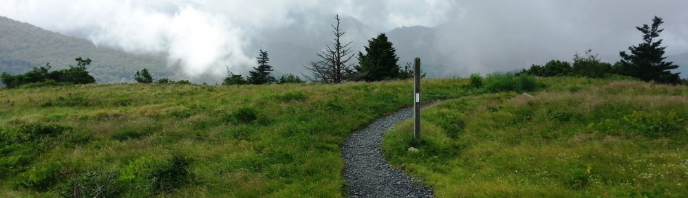
Once we started heading up Big Stamp (mi 324.5, elev 5400′) (the next bald summit over), I told him to go ahead & I’d catch up. Before we parted ways however, I got this trail name (Gnarly from Atlanta), snapped a pic & said we’d find each other’s blogs.
Traversing Big Stamp
As I walked along, we came upon a few people under a canopy. A lady turned around and said “There you are, how was your night?” It was the lady monitoring the birds from yesterday. “My night was great”. Gnarly was there chatting with them. They said “hey there hiker”, I acknowledged and kept going. Apparently their operation was to catch certain birds in nets strung up like volleyball nets, band them & count the population & monitor health, then the birds are released back into the wild.
The trail to Bald Mountain Shelter looked like an enchanted forest from some fairy tale. The fog was thick and the tree trunks and limbs were growing every which way, adding to the eeriness. I got to the shelter, a two level “bunk” type with slotted sleeping areas, perused the register, and topped off water at the spring (which was flowing pretty good and not at all far away). Once back at the shelter, I left my entry and saddled back up the trail.

Bald Mountain Shelter

A mile or so later Gnarly came motoring up behind me and said “they let me release one of the birds!” “How how was it?” I asked. “Amazing” was his reply. Once again, I let him go by me. He was flying up the hill like a man on a mission and eventually disappeared out of sight.
This morning as soon as I started up the first hill up to Big Stamp, my legs felt as if I’d been walking nonstop for weeks. They weren’t fresh. They weren’t rested. They felt like lead. With every step I took, my thighs contracted reluctantly, slowly. This is not good. I just couldn’t get any momentum. As soon as I came up any more than a slight incline, my body got stuck in first gear and every step was labored and difficult. Last night’s rest didn’t seem to the trick at all. I sighed and kept clamoring on. Remember, you have 11.8 miles to do today.
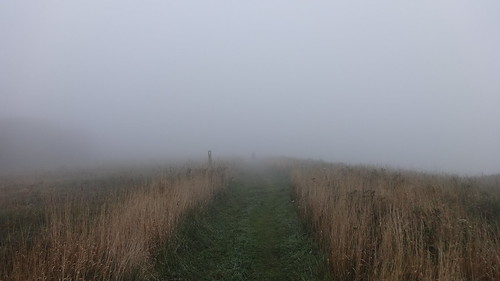
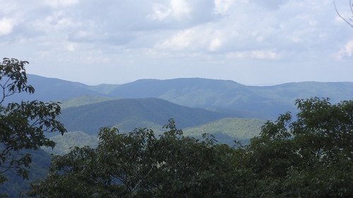
After passing over Little Bald (mi 326.5, elev 5220′), which wasn’t actually bald anymore but had one paltry little view off to the side, the trail began a series of knee (and soul) crushing descents. I came up with a theory- 50% of the Appalachian Trail is moderate and manageable ascents and descents- not too hard on the legs and the knees, allowing you to take in the scenery without putting undue stress on our legs, 10% is nice level or slighty rolling terrain- the kind you can make super fast speeds on. The remaining 40% is split between agonizingly steep uphills, where I’m slowly climbing up on my tiptoes, barely able to keep upright, or joint-shattering downhills where I must sidestep and alternate landing feet. This stretch was definitely in the agonizing 40%. It did offer one small vista worthy of a photograph, but not even that small break helped.

view from Little Bald
My left knee is swelling up quite nicely now. There is what feels like something pressing on the outside of my kneecap every time I take a step on level ground. Uphill it’s only worse. Downhill it’s insufferable. Twice I rolled both of my ankles on the slick rocks and roots and let out a yelp. This is not good. I’m fatigued to the point where I’m haphazardly planting my feet on whatever, wherever, not paying attention to what’s underfoot. Going up any type of incline hurts my hamstrings, the left (again) more so than the right. Although this is only the third day of my hike, it feels like I’ve been walking for a week.
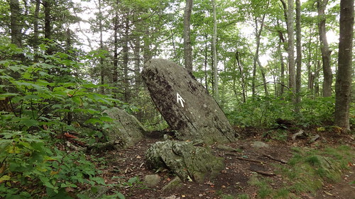
Cool rock north of Little Bald
When I took inventory of my food this morning before leaving Big Bald, I decided to stop at Whistling Gap (mi 328.6, elev 3889′) for a bigger lunch and break than usual. I’d packed a half pouch of Mountain House Mexican Chicken, and figured that would be substantial enough. As an afterthought, I added some MRE cheese spread to bump up the calories. Something I noticed was that I hardly ever STOP and REST to eat- it’s usually a rushed affair, stop, cram food down my gullet, and get going again.
Once at Whistling Gap, I set my phone timer for 30 minutes thinking it would be a decent amount of time to rest without totally blowing my goal of reaching No Business Knob Shelter before sunset. I strung up my tent & rain fly so they could dry out (they were packed up wet from the condensation last night), boiled water for my meal, and made a rare midday visit to a tree to download some excess “water”. Whistling Gap has a nice camping area, with several flat spots for tents, and a huge fire area surrounded by logs. It would make a sweet stopping point for the night, but that was not “the plan”. The plan was to get to that shelter before dark, and everbody knows that once decided, you do NOT go against “the plan”.

Whistling Gap campsite
There was only one problem. It was after 1 pm and I still had seven miles to go. With two climbs. Any other time I’d just knuckle down and do it, but my legs weren’t cooperating in any way, shape or form. Unfortunately, not for the first time was I feeling very unsure of myself. The alarm on my phone’s timer went off while I was still eating signifying the 30 minutes allocated were gone. The tent & fly still had to be recovered. I never did sit down to eat- lunch was eaten walking around the site and shaking out my wet gear. Finally the trash got bagged, gear repacked, and I set out again.
Right out of Whistling Gap I was met with an abrupt uphill that completely took all the gas out of me. I may as well have never stopped because I didn’t feel the least bit refreshed. This isn’t good. I’m huffing and puffing and struggling just to get out of the gap. High Rocks is about a half mile away, and keeping with my promise of stopping to take in the sights, I decided to take the short side trail. It went up. Steps. Straight up. All after lunch, the thoughts of bailing out were creeping through my head.
Just stop. You won’t make it 7 more miles. There’s no established campsites between here & there. You’ll be stuck. You’ll be walking and setting up after sunset. You can bail out at Spivey Gap. Just call Uncle Johnny’s and pack it in.
I trudged up the trail to High Rocks and took in the view. Do it. Bail out. The vistas were pretty good. It was a giant rock slab jutting straight up from the ground, and the side trail wound around it. Call them. Bail out. I set my pack down & surveyed my guide, map, and phone. There were still 6 1/2 miles to go with a moderate climb near Oglesby Branch. Do it. Shortly after getting up there, a rather large & ominous cloud creeped overhead, and three or four raindrops hit my face.
That’s it. My cell phone took a minute to come out of airplane mode and catch a signal, but once it did, I placed a call to Uncle Johnny’s. “How much to get picked up from Spivey Gap?” “$25. Where are you?” the man on the other end said. “I’m at High Rocks. I can be down at the road in about an hour”. US 19W was 2 miles away, but hell, it’s downhill for Pete’s sake. “Okay, we’ll meet you out there”.
Not even this view from High Rocks could save me
No turning back now. The deal is done. For the first time this year, I’m bailing out on a hike before it’s complete.
I felt like a turd for not having met my goal. Although an almost 12 mile hike on day 3 seemed lofty, I’d done it before, going into Damascus and Hot Springs. Just not after getting thrashed the day before. For some reason, my confidence was shaken, badly. I doubted my physical abilities and stamina just as I’d done yesterday going up to Big Bald.
On the way down I my eyes were fixated on the ground, watching where my feet were landing, barely looking up at the scenery. There’s no need to I guess. I’m going to my truck and going home, a day early. None of the passing scenery caught my eye, although I halfheartedly stopped to snap a few pictures on the way down.
All I thought about was getting to Spivey Gap and getting the hell ouf of the woods. I crossed the last stream and campsite and could hear voices not too far ahead. As I passed the last white blaze, I unceremoniously took the requisite photo, turned the corner, and saw two men in the parking area. It was Columbo, seated leaning up against a pole, and another burly looking gentleman wearing a red sleeveless shirt.
“Are you Shannon?” “Yes I am. How long have you been waiting for me?” I asked. Columbo promptly said the guy had been there for at least 20 minutes. Damn, I guess coming down took a lot longer than I had planned, but after I made the call to tap out, I didn’t really pay much attention to my watch. It didn’t matter and I didn’t care. I wished Columbo good luck for the rest of his hike, got in the car, and bid farewell to the Appalachian Trail, at least for this trip.
The driver’s name was “Sarge” (as in Sergeant of Arms for his motorcycle club), and the drive back took a little longer than the drive getting to Devil Fork Gap. I wasn’t much for conversation but was polite. We stopped at the gas station so I could hit the ATM to get some cash to pay him, and then once back at Uncle Johnny’s I bought a bandana, sticker, and got in my truck heading back to Charlotte, feeling like I didn’t accomplish anything at all
To add insult to injury, 20 minutes up the road on Interstate 26, only 2 miles from Sams Gap, my transmission died.
Remember the photo I took yesterday?  The spot where my truck broke down is just past the first rock cut on the far right.