1 JUL 14
Roan Mountain trip: Day 3
Roan High Knob Shelter-Bradley Gap
Miles today: 10
I go to nature to be soothed and healed, and to have my senses put in order.-John Burroughs
0615- Roan High Knob shelter (mi 376; elev 6275′)
Geez the people upstairs would not stop talking last night. Oh well, the sun is up, somewhere in the world at least. I mean it’s obviously daylight outside, but I can’t see the sun because there is a cloud enveloping us. I keep forgetting that up at 6000 feet we are up at cloud altitude. My socks and shoes are wet. Still. Not again, but still, as in continually wet since I arrived at Greasy Creek Gap. I changed my shirt but figured I’d rather have one clean dry pair of pants & socks for tomorrow so I kept the nasty ones on for another day. They’ll get dry once I start walking anyway, providing there’s no more precipitation. Sometime during the night, a mouse decided to leave a little calling card on top of a baby wipe I forgot outside my tent. Nice.
Even though the guide shows water at Carver’s Gap, I topped off anyway. Started down the side trail, then hit the AT northbound. Needless to say, it was full of rocks. Not rocky, but composed entirely of rock. The baseball sized ones that roll all over the place and dare you to keep your footing. I know they were there for erosion control, but with the heavy rains the last few days not only were they slippery, they were loose as well. This made for a very slow and methodical descent down.  I came upon two gentlemen who stopped to say hi. (This chance meeting will be of minor significance later). I asked how the trail was down to the gap, and they said “same as this”. Crap. 2 miles of this? So much for making up any kind of time, walking at a quick pace willy-nilly is an invitation to a nice sprain.
The scenery down was beautiful, but couldn’t take my mind off of the ankle snappers. During my laughable game of hopscotch, I set my right foot down on a rock, which immediately flipped over, turning my foot painfully inward to the left, Ow! That hurt. It’s not the typical ankle rolling you’d think- the bottom of my foot didn’t go inward, it went outward. That hurt pretty bad, but I kept going. “Just pay attention” I muttered to myself. 15 minutes later the same thing happened to the same ankle. Arrgh! I yelled out loud this time. Stupid ass rocks! Sigh. Keep going. Guess what happened AGAIN just a few moments later? Ok, now I’m injuring myself. Putting pressure on my right foot is starting to hurt all the time now. I’m about to sprain my damn ankle coming down this mountain. I’m hobbling on the tiptoes of my right foot using my trekking poles as crutches. What a circus act.
Somehow I made it down to Carver’s Gap (mi 377.5; elev 5512′) in one piece. The trail right before the gap wound through the best scenery I have seen in a while. Sadly, I was messing around with the white balance on the camera, so NONE of the pictures came out looking right. Of course, the landscape was going to change abruptly from alpine-like forest to the balds. Once down I walked up to where I saw cars parked, then walked to the other parking lot, hidden somewhat behind the road, looking for the water point and trash can. Not wanting to wander all over the place with my pack, I crossed the road (after snapping the requisite pictures), took off my pack cover & leaned it up against the fence, and walked back across the road to find the water point. The bathroom seemed to be occupied by a hiker, but I didn’t really need to go anyway.
I walked towards an old couple to ask where the water point was, when two young ladies with a dog came up and asked us “which is the best way to walk?” “Head up towards the high groud- that’ll take you to the balds”. They were about to just walk down along the highway for goodness sake. Didn’t they read ahead or look at a map? Anyway, the older gentleman said he didn’t know where the water was but offered me a couple bottles. I was gracious since I wasn’t totally out (my water bottle was full & still had some in the platypus) but no way was I going to turn down water. He asked if I was thru hiking. I said no, I was just doing a section, but that made me wonder if I smelled that bad, ha. He even took the empty bottles saying there’s no need for me to carry extra stuff. Good deal. I hung around for a little while waiting for them to get started up the trail, but they were taking too long so I said my thank you’s and goodbyes and headed off. By the way, as soon as I started up the balds, THE SUN CAME OUT. Glory glory hallelujah!
 The initial climb up wasn’t too bad but I did need to take a couple breaks. The two girls with the dog kept leapfrogging me as we stopped at different times. Round Bald’s view was decent since it started clearing up. Jane bald was so-so. Kept moving past Grassy Ridge Bald, although in retrospect I should have taken the ¾ mile detour since apparently it has the best views. The footbed in this section went from a nice and firmly packed bed of gravel to a VERY narrow dirt path- no wider than the length of my foot. That and the fact that the trail was worn down about 8 inches lower than the surrounding ground makes it hard to judge exactly where the uneven ground is, and it also makes you have to walk like you’re taking a field sobriety test- placing one foot directly in front of the other.
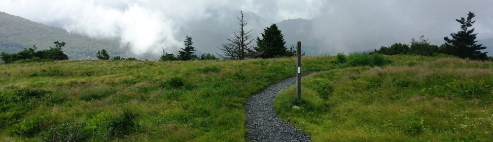
Going around the back side of the balds, the trail went through some relatively dense, waterlogged brush. Flies were everywhere. I mean everywhere. My two days’ worth of trash is definitely attracting them, but they weren’t anywhere as bad around Carver’s Gap. On goes the head net. At least the sun was out and that gave the scenery some color instead of the dreary gray that dominated the last 2 days. The spruce & fir forest must look wonderful when the sun is shining.

Gray’s Lily
Made it to Stan Murray shelter (mi 381.2; elev 5050′) for lunch. A guy with a teenager and a younger kid was there. We talked for a bit & he mentioned that a) the older kid was joining the Air Force in a couple weeks, and b) they were headed NOBO. I mentioned Overmountain Shelter as a must-see, & that I’d be checking it out as well. They took off and I made my lunch. The flies were absolutely merciless. They were so bad I didn’t bother sit down to eat; I just walked up and down the trail in front of the shelter and the damn things kept following me. GO AWAY! I had planned to wrap my ankle but didn’t because of the fly harassment, didn’t even jot anything down in the shelter register. I wanted out of there with a quickness. Time to leave the plague and get hiking. Took a Tramadol for my ankle & bugged out.
Walked the 1.9 miles up to the Overmountain Trail intersection being followed by the same damn flies (or at least I thought). Flies. Flies. Flies. Buzz. Buzz. Buzz. Buzz How absolutely annoying. The Overmountain Shelter (mi383.1; elev 4550′) is down in a draw with a pretty steep descent to get there, and I knew I was going to regret the decision coming back up. Once down there, I was treated to an amazing vista. Since the clouds burned off there was actually a great view of the valley and the mountains in the distance. The old red barn was pretty interesting. There are sleeping platforms on the open downstairs, and a spacious upstairs. The guy & kids from Stan Murray were there. He introduced himself as Eric (“Green Bean”) and the young kid was “Half Day” and the older one “Spider”, and thanked me for the idea on the shelter. It was only 1500 or so (my phone battery was at 17% so I’d stopped recording my track and shut it off).
Green Bean was pondering staying here or moving on. I was in the same predicament. My original plan was to stay here overnight and enjoy the sunset/sunrise) but it was early yet, and the thought of sitting around talking to no one for hours before sunset wasn’t too appealing. Not wanting to burn daylight, I’d made up my mind to head up to Little Hump & camp there for the night. That would also keep me from having to tackle both Humps and do 10 miles on my last day. Green Bean & his boys took off, and I was headed up Little Hump 10 minutes after them.

View from Overmountain Shelter

Ascending Little Hump
It wasn’t a Little Hump, by any stretch of the imagination. I climbed 805 feet in 1.5 miles. It wouldn’t have been so bad but remember, this was in the afternoon and I was dragging ass. Up. Up. Up. Up, Up. Did I make a mistake? Up. Up. Up. Should I have stayed at the Overmountain Shelter? Casting a glance over my right shoulder, it was still visible, tucked down in the valley. Off to my right, I spotted a single rare Gray’s Lily. I had to pace myself again. 40 steps, stop, 40 steps, stop. Take a few pictures. 40 steps, stop. My feet are starting to get a little angry at me. Little Hump has a couple false summits, but that didn’t break me. I was on a mission. 50 steps, stop. 50 steps, stop. Came out into the final clearing near the summit & saw Green Bean & company. My brain said “catch up to them” but my feet & lungs said “go to hell”. They had stopped at a rock formation & said “wow views everywhere- we’re gonna camp here”. I pointed forward with my pole & said “I’m going all the way to the top”.
The view at the top was definitely worth it. Abso-freaking-lutely beautiful! The summit (mi 384.7; elev 5459′) had a 360 degree view. I dropped my pack & spent about 20 minutes taking it all in. A butterfly even landed on my leg, as if to say “hey you made it, welcome to Little Hump”. I could see Grandfather Mountain plain as day off to the east. Surveyed the camping area and checked the weather forecast. There was a 20% chance of rain (and possibly a thunderstorm) that night. The site was definitely exposed on the windward side of the summit. Had it been on the eastern side I wouldn’t have given it a second thought, but I didn’t want to chance it. I consulted Guthook’s guide and saw there were two campsites down at the base of Little Hump and Bradley Gap, less than a mile and a half away. Downhill. Screw it. I have 2 hours of daylight still. Let’s do it. I was dead tired, but the site was near water and I definitely don’t like being low on the wet stuff.
Slogged down the hill to the first campsite I saw. It was a decent size. But the ground was mostly bare, and barely dry. I turned my phone on one more time to check the picture on the guide to make sure it was the right one, and I saw the same crooked trees, so that was that. Home sweet home for my last night in the woods. Dropped my pack, and found a tree suitable to hang my food bag. It was actually the very first hang I did (not wanting to take chances of any bears or critters getting into my crap). I cut the little Dasani water bottle I had my hooch in (it was finished last night) in half, poked holes in it, and mouseproofed it. I was pleased with my amateurish handiwork.
After picking up the tent and moving it about 12 times, I finally said screw it and staked it in. Flies are buzzing everywhere down here too, you can stand there and hear them buzzing all around you. What the hell is the deal with these flies? That’s the other reason why I hung my bag 30 feet away- the trash is in my sleeping pad bag. Had MRE beef stew with KFC Hot sauce for dinner so I wouldn’t have to use a lot of water (but that wouldn’t matter later). A piped spring was .2 miles down the trail, so I topped everything off. There was a couple at a campsite down there. Once I got back, I heard yet another couple seemingly standing on the trail talking to each other. Come to find out there was a campsite across the trail from me about 50 feet away. At least they weren’t rowdy. Settled into my tent, absolutely bored with nothing to do. My iPod was dead, I had to save my phone battery since my battery pack was totally dead too, so I journaled the notes from the day.

campsite near Bradley Gap
At 1920 a group of about 7 came traipsing down the trail northbound. I was hoping they would keep going as they were young, loud, and I didn’t want company, not that kind at least. They stopped, probably seeing my tent, and went across to the other site. Apparently they were surprised to see someone had occupied that one too, so they kept on moving. “Oh someone else is camping here too, we’ll just find another site” said one girl. Geez people, you should know better than waiting until late to find a site…
At 2035 another group (or maybe the same foresaken clan) came southbound with every last one of them talking and yelling. Shut up already. A female voice said “how far is it to the next campsite?” A guy says “I don’t know just keep walking”. Another older guy, maybe their fearless leader said to someone (sounded like he was on the phone) “It’s okay, we’re still walking. We’re not in panic mode yet”.
Umm yeah, you SHOULD be in panic mode buddy, because there’s not another campsite or even a clearing large enough to fit all of you, unless you go all the way up to the Little Hump summit. A few questions: 1) why are you still walking along without a plan where you’re going to camp? 2) Who has the map or guide telling them where the sites are? 3) Has anyone in that group even been here before? 4) Whose idea was it to hike this late with all these people HOPING to find a campsite? Glad I’m not with them. They’ll have fun hiking up to the next site. Happy trails!
My sleeping bag was damp and now it smelled funny. I walked my socks and shoes dry, although the insoles are still a little damp. Did a few minutes of “coffin yoga” to stretch my legs out and tried my best to elevate my now swollen left knee.
I have 6.5 miles to do tomorrow. The Hump Mountain summit is .9 miles away with a gain of 637 feet. That’s doable. From there it’s downhill the rest of the way to US 19E, with a decent drop at Doll Flats. I hope to be walking by 0700, summit Hump in an hour, get to Doll Flats in about another hour or so, and take another hour and a half to get to US 19E. Shooting to get from here to the B&B in 4 hours. That’ll be making reasonable time.


Looking north toward Hump Mountain

Roan Mountain forest


